An intuitive tool to control your GPS-tagged animals from everywhere!
Key features of WildlifeMonitor
- Monitor your data with an intuitive and instant display
- All functionalities on mobile devices
- Alerts and push notification on your smartphone
- All tag types in one place
- Centralised data storage
- User defined data queries
- Attractive public maps which can be integrated into your website
In Preparation
- Map Compiler: Display animals according your choice
Please contact us if you would like to include your tracked animals in the WildlifeMonitor
Features of the WildifeMonitor
The following pictures show the key features of the WildlifeMonitor with a short description of the most important elements.
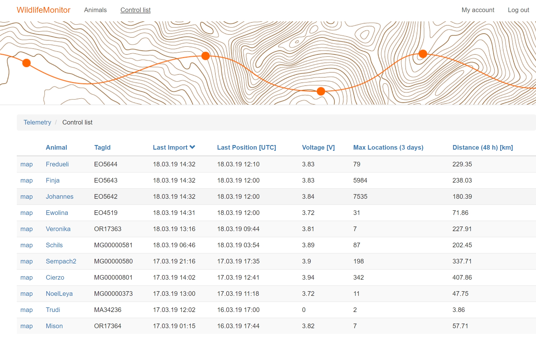
See all of your animals in one place
You have the key parameters for every individual at your fingertips (tag ID, last import of data, last data position, voltage, the maximal number of locations over the last 3 days, the cumulated distance over the last 48h). All inactive tags are filtered to keep the active tag list clean.
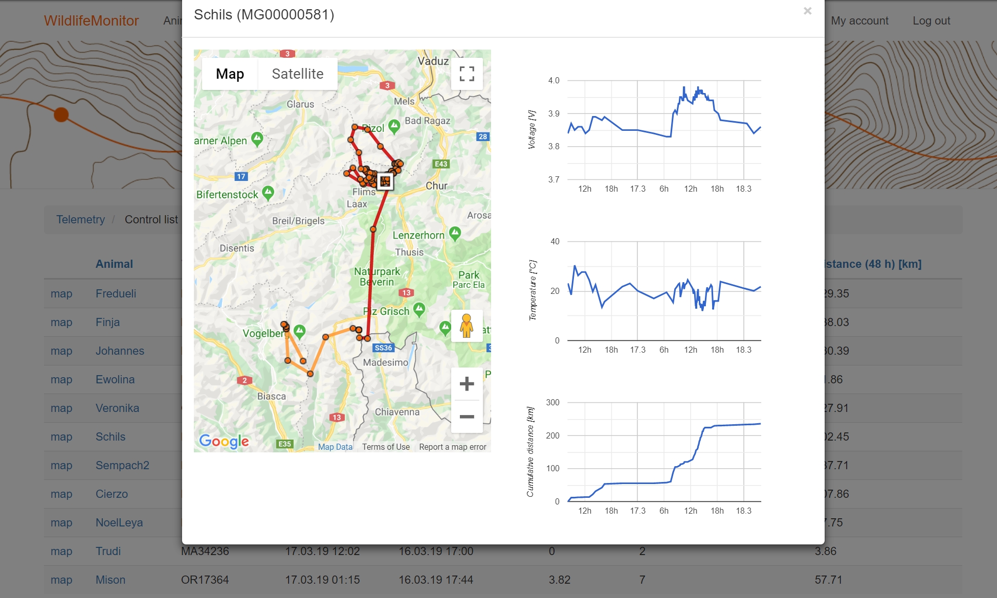
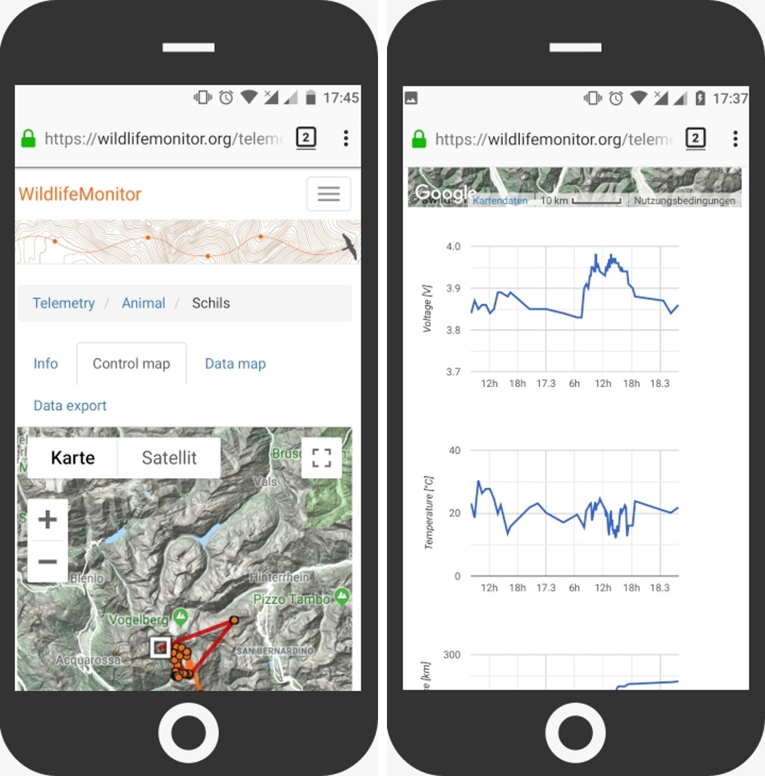
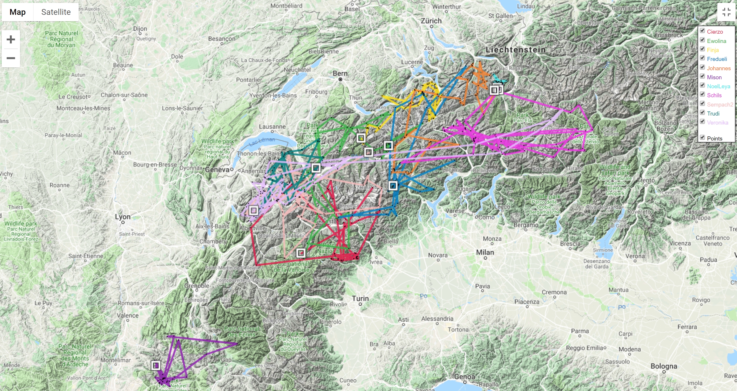
Monitor the movments of your animals on maps
Two different map display panels are shown, the “control map” and the “data map”. The "control map" shows the data of the last 48h hours to get a quick overview about the most recent movement of the animal. Next to the map three graphs show the voltage, temperature and cumulated distance for the last 48h. This map is used for the day to day data check.
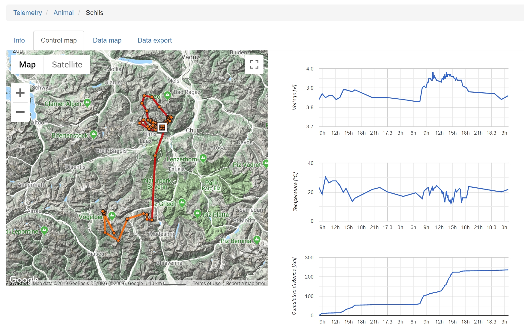
The “control map”
You have access from the control list by either clicking on the animals’ name or alternatively via a pop up which is behind the “map” link.
Accessible on every device
The WildlifeMonitor has a responsive design and works on all devices (laptop, tablet, smartphone)
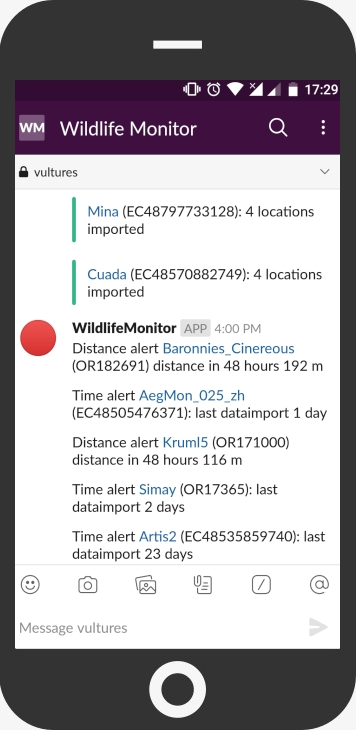
Alerts and push notification by slack
- Information about new data imported into the WildlifeMonitor with direct link to the control map
- Distance and time alert sent once a day, including details of the detected issue
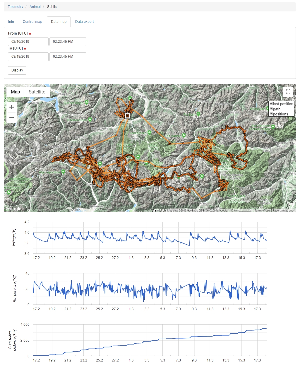
The data map
Shows any user selected interval by date and time. Battery voltage, temperature and cumulated distance are shown here for the selected time period.
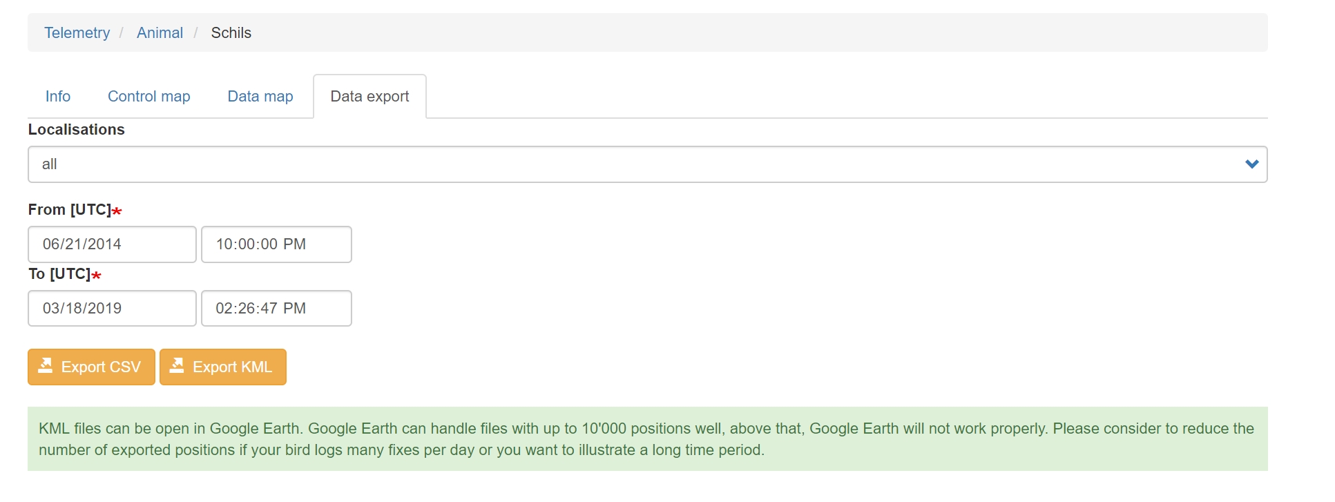
The export tab
Enables you to export all data from the respective animal from a user selected interval in two different formats: kml and csv.
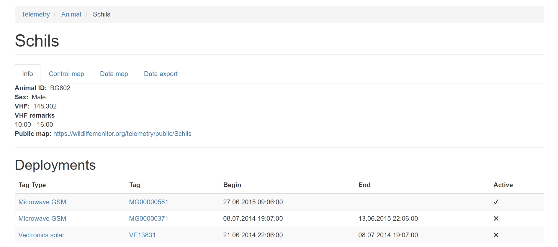
The info tab
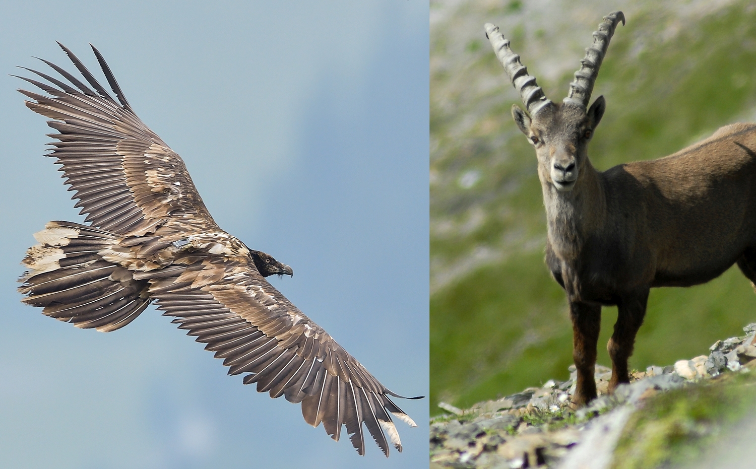
Shows all details of the animal like sex, ID, marking information. It also includes the VHF frequency and can contain a picture.
Individual user access
Access to the WildlifeMonitor is by individual access with username and password. Only registered users can see any data and project managers have full control of who has access to the data. It is also possible to give access to single selected individuals for a limited amount of time, e.g. if an animal is outside of the usual range and there is a need for locals to follow the movements.
Public maps of animal movements – on your website
The WildlifeMonitor can create public maps for each individual. These public maps show only one mid-day data point with a one-day delay. User defined logos with hyperlinks can be included on the map. The provided URL link can be integrated in one or several websites.
The following features are still in development
Combined maps
It will be possible to combine the tracks for a group of animals and time period (both user defined) and display them in a map. The map can be public or internal.
Tags implemented
Currently the tags from the following companies are implemented in WildlifeMonitor:
• Ecotone
• E-obs
• Microwave (GSM and Argos)
• Ornitela
• Vectronics
Tags from other companies can be included upon request (may need some programming). Please contact us if you have other needs.
Pricing
We have special conditions for users starting in 2019:
The fee for using the WildlifeMonitor is comprised of a partner fee and a fee based on the number of tags. For each new partner there is an initial partner fee of 250 Euros. You then have the option to select between two different price models:
Fixed price:
The full package (implementation animal, public map, basic fee) will cost you 400 Euros per animal.
Time dependent:
Implementation fee: 200.00 €
Public map: 50.00 €
Basic fee for 1 year (5 Euros/month)*: 60.00 €
*This will be charged for full months of deployments only
Depending on the total number of animals implemented at the same time, price reductions are possible. For a limited time we provide access to a trial licencse: Please contact us